This is the After Event Recap from our 2024 Big Game Hunting event. This was a direction-finding event but without the driving and walking around from similar Fox Hunting events.
You can review the event objectives by reading…
2024 Big Game Hunting Instructions
2024 Big Game Hunting Announcement
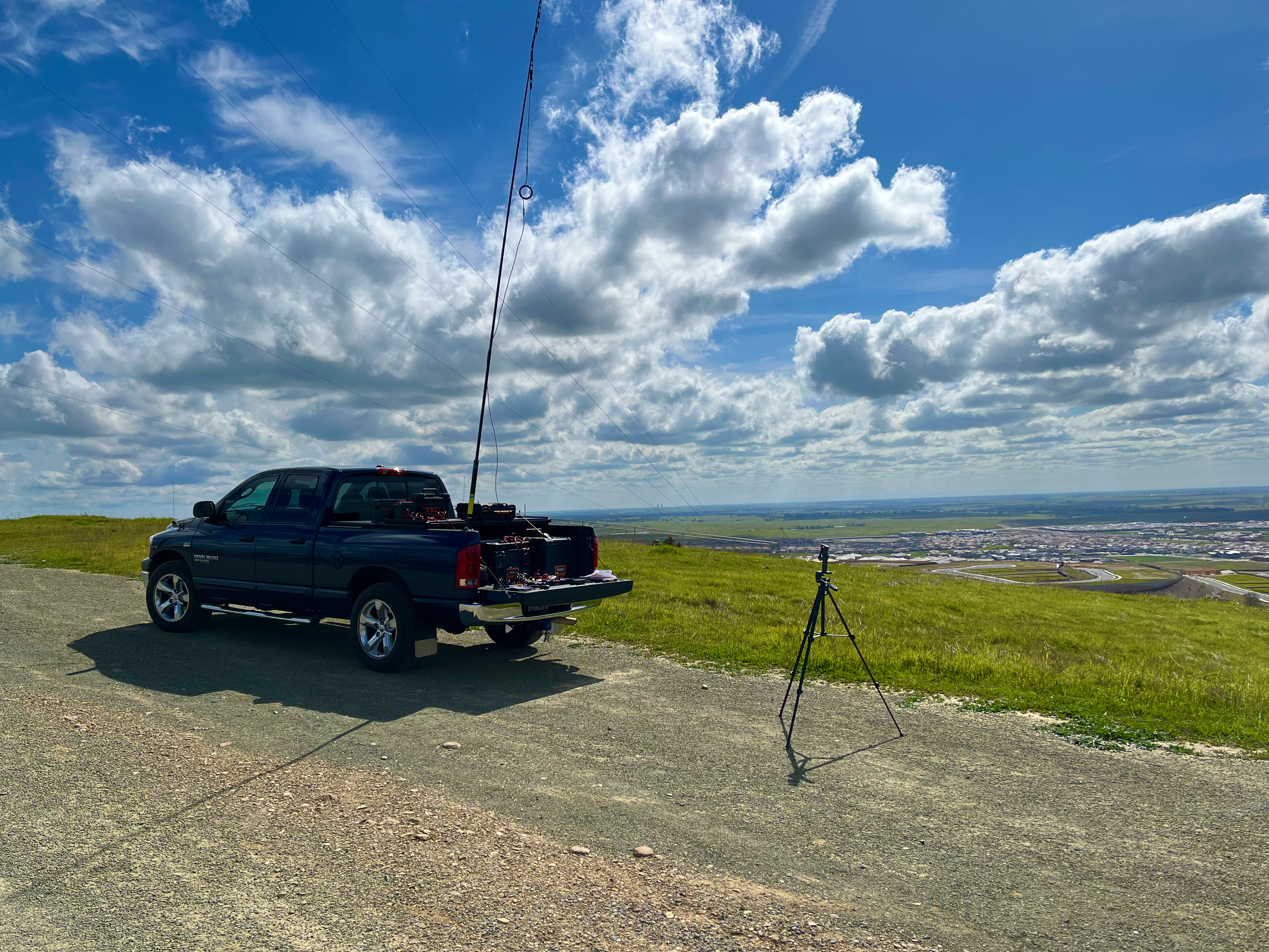
I chose Carpenter Hill for my operating location. No one else knew where I was. It was their job to discover my location.
Carpenter Hill gave me a few advantages for operating. I was not really sure how well this event would work with the hunting stations spread out throughout Sacramento County. As it turns out, Carpenter Hill was more than adequate for our needs.
Carpenter Hill is the highest point in Sacramento County. It is located in Folsom on the north side of Hwy 50. The video panorama shows my location and the excellent views to the south, west, and north.
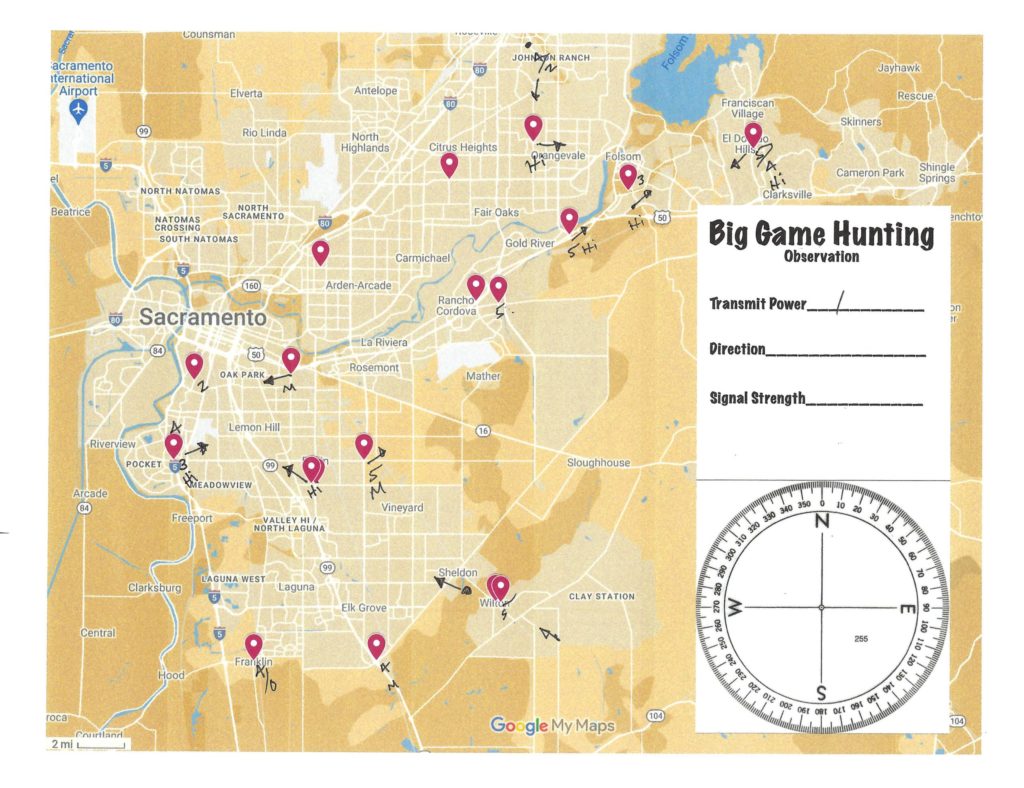
We had roughly 20 stations pre-register for this event. That was very helpful in determining where and how I should operate. We had stations ranging from Citrus Heights in the north, Land Park and the Pocket area to the west, down to Franklin, Elk Grove, and Wilton in the south. The pre-registered stations are represented by markers on our Observations map.
I operated in five distinct iterations. I started with 50 watts PEP just to make sure everyone could hear me. In retrospect, that was overkill, but it did establish the top end of the signal reports. 50 watts of FM from 850 ft elevation returned reports of Q5 signals even more full-quieting than the repeaters.
In each iteration I operated with my mobile-as-a-base transceiver using our homemade slim-jim antenna made from 450-ohm window line from our antenna build event. I then jumped on an HT to gather observation reports from stations on the repeater. For the 1 watt iteration I attached my HT on low power to the same antenna.
Several stations were using their tape measure yagi antenna that we all built together in addition to using omni-directional vertical antennas.
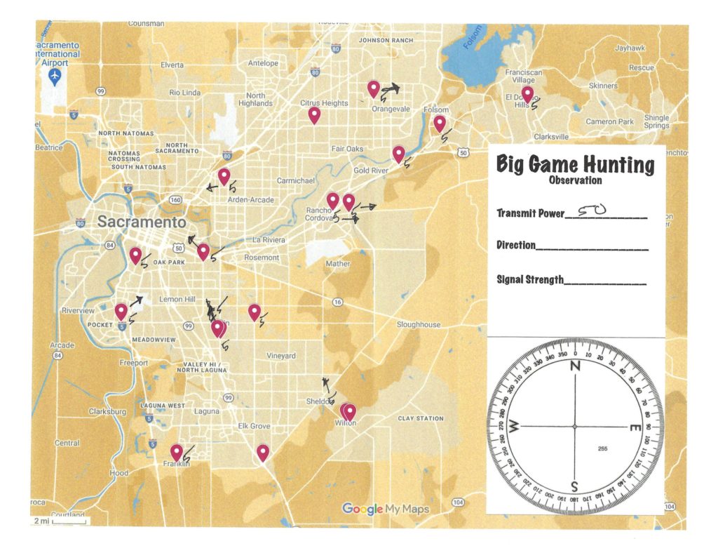
50 Watts
Here is how I used our Observation Map. I recorded Q1-5 signal reports and also drew arrows based on the station reports. As you can see, some stations had me pegged right on, but there were several stations reporting varied compass directions from their QTH.
My notes are not 100% exact or accurate. The idea was for the hunting stations to work together to find me, and the blowing wind on top of the hill kept me busy. But all-in-all the recording went pretty smoothly.

20 Watts
At 20 watts you can see that the signal reports are still Q5 and some directions are right at me. Interestingly, some stations still reported that my signal was nearly opposite of my true location.
We used this event as a learning opportunity, and we did learn a few things.
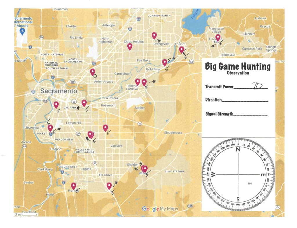
10 Watts
At 10 watts I was really hoping to get some diminished signal reports. The Wilton stations did report a Q3 on a vertical and also reported they had to remove some inline attenuation to keep my signal strong. That should have been a hint to stations that I was not near Wilton.
We still have stations pointing in the opposite direction. I tried to give some hints about being 90 degrees clear of the director and reflector elements on a yagi, or perhaps bounced signals, but they stuck to their observation reports.
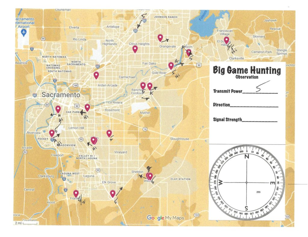
5 Watts
Surprised to still have so many Q5 reports. You’ll notice that we picked up a Roseville station, and we did have a mobile station tracking me in their car (even though I made it clear there was no expectation to do so). The mobile station even took advantage of tracking me using the input frequency to the repeater to get some additional observations.
At essentially HT power, everyone could still hear me very well. I also started asking for a confidence score if they had to guess right now. Unsurprisingly, the stations near me had high confidence.
1 Watt
Q5 reports at 1 watt? Yes, many of them. There were some lower reports – especially near downtown. This should have been a clue that I was not near downtown.
The Franklin station was a good example of having two signal reports – one from an elevated antenna versus a ground-level antenna such as an HT.
Knowing that this was our last round, I asked, again, for a confidence rating and most stations were set firm in their observations. I commend the stations who had strong conviction.
Most stations were very consistent with their reports over these last couple of iterations.
When I finally revealed my location I polled each station for their reaction. I did not take super good notes, but here is a summary.
- Tunnel vision – some stations admitted to sticking to their first assumption rather than comparing their results with the other stations. I chalk this up to the fundamental difference between Fox Hunting and Big Game Hunting. In Fox Hunting you are working independently, and might be competing, from the other stations. This event was trying to promote cooperation.
- Unpracticed with directional antenna – and that was what this event was created to do, to give us some practice time. Learning about body attenuation, reflected signals, broadside clearance, etc. Sure, we can read all about it and we can watch videos about it, but until you actually hunt a signal using a new directional antenna you don’t really know.
- Attenuation – even the stations with signal-hunting experience appreciated having to use a variety of attenuation techniques to find me. When I was operating I tried to transmit for three to five minutes each time to give each station some time to try a few things – attenuation, aiming, moving around, etc. And with such an apparently strong signal from 50 watts all the way down to 1 watt it did provide plenty of opportunity to try a few things.
- The biggest hint I gave was when the station operating from inside an office building in Rancho Cordova/Mather area was experiencing different signal levels – attenuation – when walking from one side of the building to the other. The western-facing windows had a very poor signal report while the east-facing windows had a very strong signal report. A good clue that I was not in the downtown area. I highlighted this “office building attenuation” a couple of times.
- The biggest hint I gave was when the station operating from inside an office building in Rancho Cordova/Mather area was experiencing different signal levels – attenuation – when walking from one side of the building to the other. The western-facing windows had a very poor signal report while the east-facing windows had a very strong signal report. A good clue that I was not in the downtown area. I highlighted this “office building attenuation” a couple of times.
- Map Orientation – this one surprised me. There were a few stations who admitted to not knowing all of the locations we were reporting from. Our observation map and list had the registered stations identified by landmark or major intersection (versus specific QTH street). But still, not knowing where to find these on the map hindered some from using the map to help them with their observations.
The overwhelming consensus was that this was a fun event and that everyone enjoyed the challenge. We will certainly do this again but with a not-so-advantageous location. I think many stations might invest in a directional antenna at some point.
You must be logged in to post a comment.